If the world is never viewed directly, it is impossible to decide between shadows and reality. If, in truth, they are only shadows that flit outside her window, then there is no loss for her who must see only their reflection. But if they are more than mere shadows…? There were times when she was seized by a sudden desire to rush to her window and look out freely over the world that existed outside her mirror.
Natsume Sōseki,Kairo-kō
The map of The Death of Arthur is finally complete. At least… until the next time I want to change it1.
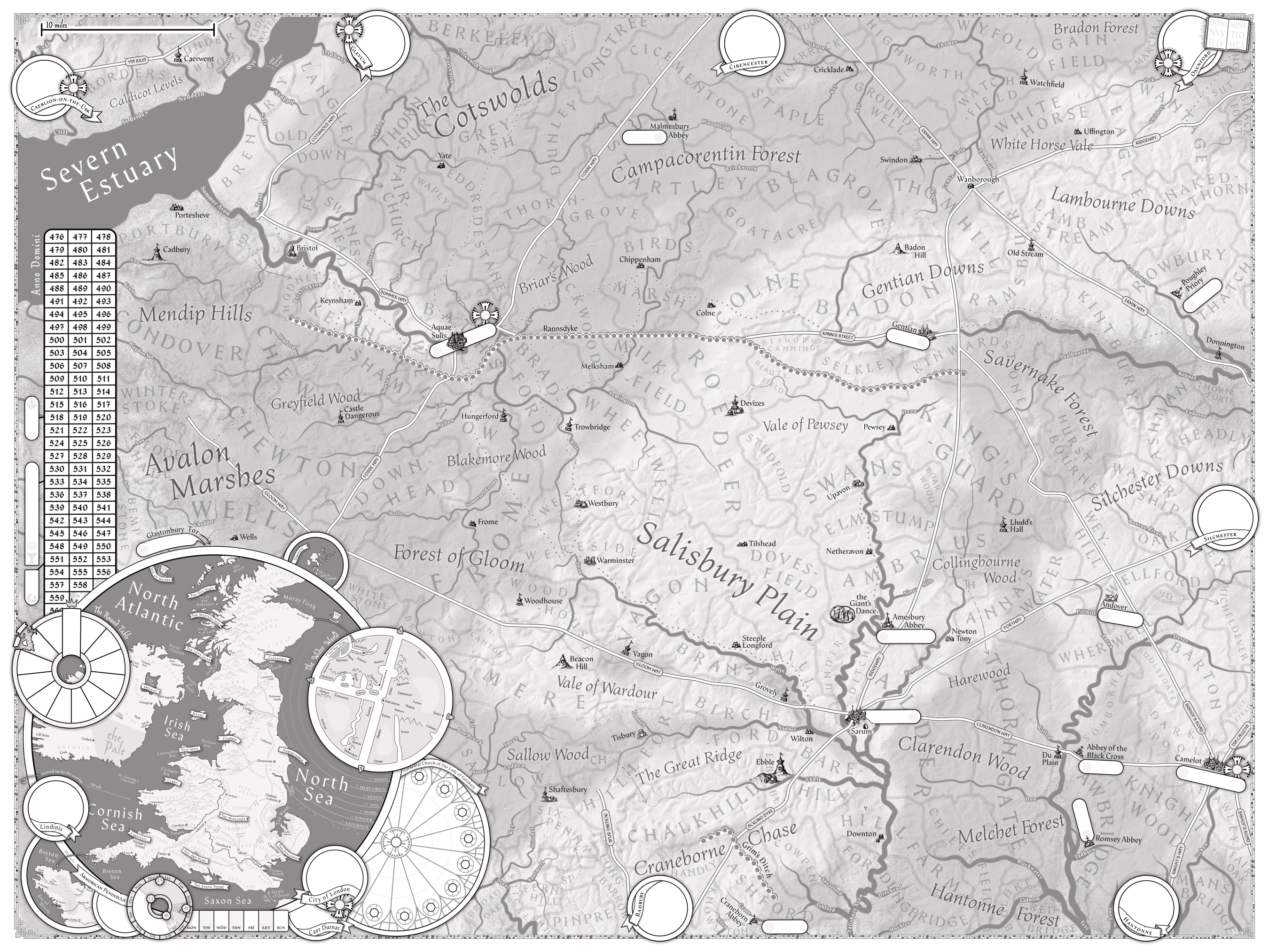
…and by “the next time I want to change it”, well, when I started writing this post2 the map actually looked like this:
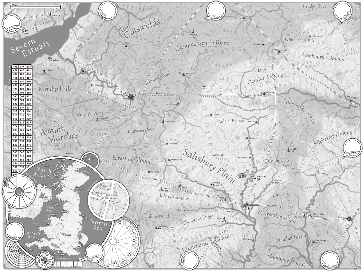
So instead of tinkering with it endlessly, now is probably a good time to talk about what I want it to do in The Death of Arthur.
What is the Purpose of a Map?
My first foray into rpgs-with-notable-maps was in Kingmaker, which has as one of its central gimmicks a hex map. Imagine this3…
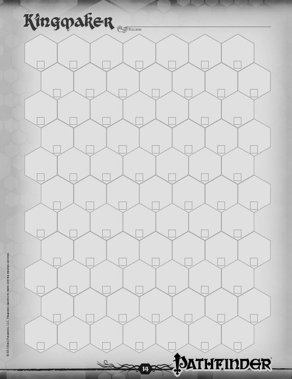
…but covered in a lot of incomprehensible smudged penciled in text over time. Kingmaker’s map is both a hex-crawling and a hex-claiming map for the short period the realm building part of the campaign starts in earnest. The focus is on exploring—or more specifically uncovering—the map incrementally in order to trigger events or be able to claim more land in conveniently 12-mile-across bites.
It wasn’t especially successful4 but it had a purpose, and a unique one. Most campaigns5, including the later resurrections of Kingmaker my party played, instead focused on the map as a lookup table. It’s easier to namedrop a location and have the players have a rough idea of what that implies based on how close those people are, who else neighbors them or is in between us, and how scary they look.
That latter kind of map is what I had in mind when I started tinkering with maps for The Death of Arthur—a collection6 of maps to just show where everything was.
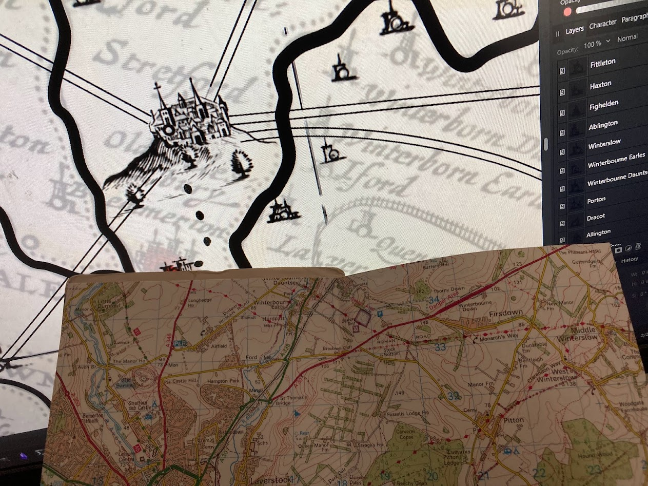
And to be big. That is in its own right a role for a big prop like a map; looking impressive and focusing the party’s attention on it7.
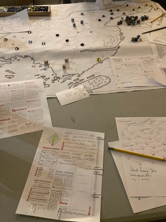
This is Hlér’s Isle (modern Læsø) from A Wind Age, A Wolf Age.
It’s big8.
And it was an afterthought.
I had very little idea what I was going to use it for, and didn’t have that many landmarks to show on it9, so I made a simplistic purpose for it. It was split into little sections to represent where each family held influence, which I auctioned to the players at the start, dividing the rest to NPC houses.
This turned out to be one of the best things I did for the campaign.
First, just seeing other players around the map satisfies a primal player fantasy of the generals around the map10. But overlaying the family influence on the map meant a lot of locations were now built into by the players, or remembered as part of their designs. That’s happening near my barley fields, or it’s in their vegetable fields that I want to consolidate my power around the port.
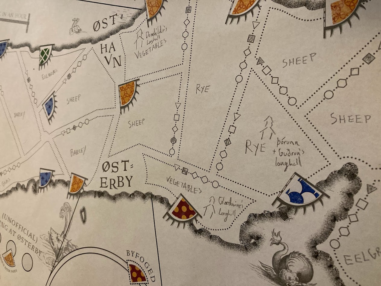
Quickly renovated with colored stickers11 and a pretty vague “get a die for each territory you control, pool them into actions” mechanical benefit, this map became the new starting point for my thoughts on The Death of Arthur.
What is the Purpose of The Death of Arthur’s Map?
From the above, I knew I wanted:
- A big map.
- Only one (primary) map. Thus a map that had more descriptive power for pointing out bigger regional issues than Hlér’s Isle12, without a bunch of alternatives13.
- An evolving map14.
I still want a map to be useful for namedropping locations—but especially local ones15 or major landmarks—but also to show the changing player-facing political landscape.
I want the map to feel like it’s shaping decisions. Hlér’s Isle had a little bit of this by the accident of the arbitrarily drawn land lot shapes, the locations of the major towns, and a couple geographical features16. The Salisbury plain also has roads, streams, woods17 and a lot of settlements compared to the island, with several types of them being potential flashpoints for power.
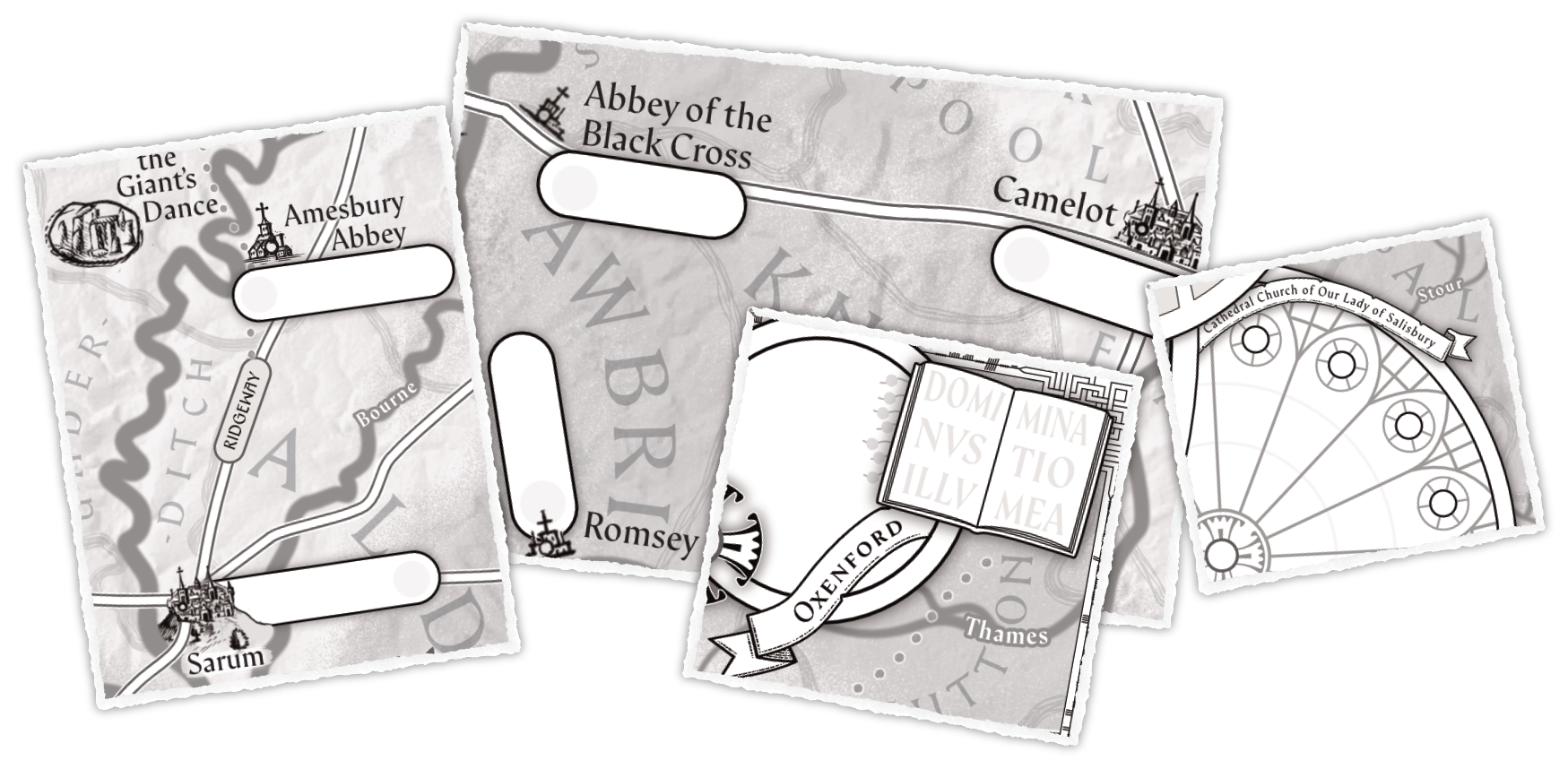
Do you care about controlling the lands around Sarum, or having influence inside its walls18? And what about the neighboring towns? If the church gets involved, is your family in the good graces (or the pocketbooks of) the powerful abbeys, the seat of the bishop, or maybe a player in the halls of that little university?
I also want this detail to help players to feel comfortable in their characters’ skins—not always beholden to the GM to make reasonable plans about the place they grew up in. Or to sometimes feel properly uncomfortable, like the feeling when you see storm clouds in the horizon and know it’s coming your way.
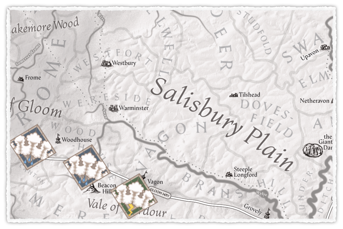
(very WIP design of cardstock elements to toss on the board when it’s interesting19)
Or like that feeling when there’s smoke on the horizon and you know what’s over there (except that in this case, that’s maybe raiders, or it’s the beacons20.
The Scope of the Map
The island of Læsø is 40 square miles. This map is bigger21. Here’s some arbitrary reference points:
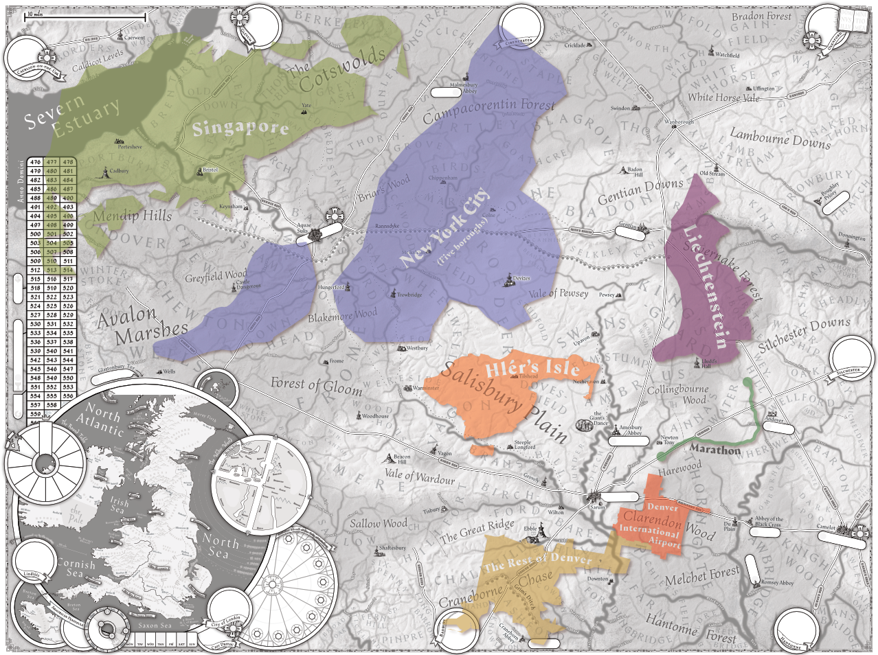
It roughly follows22 the 6th edition county map but even before that came out I had been planning on something of a similar scale23.
Both larger and smaller scale maps end up needing to focus more on mutable landmarks, constraining the design or requiring multiple versions over time24. I also learned from the map of Hlér’s Isle that players could have a fulfilling campaign in just a single Hundred, but it was hard to fill in with actually relevant details and hard to give a clear scope for neighboring situations2526. I want to put not just the main “playable area” but also the “mountains you can climb” on the board for the players to see.
I also wanted to avoid having a second broader scope map to switch between, but need a way to reference the wider world, so I snuck that into an inset.
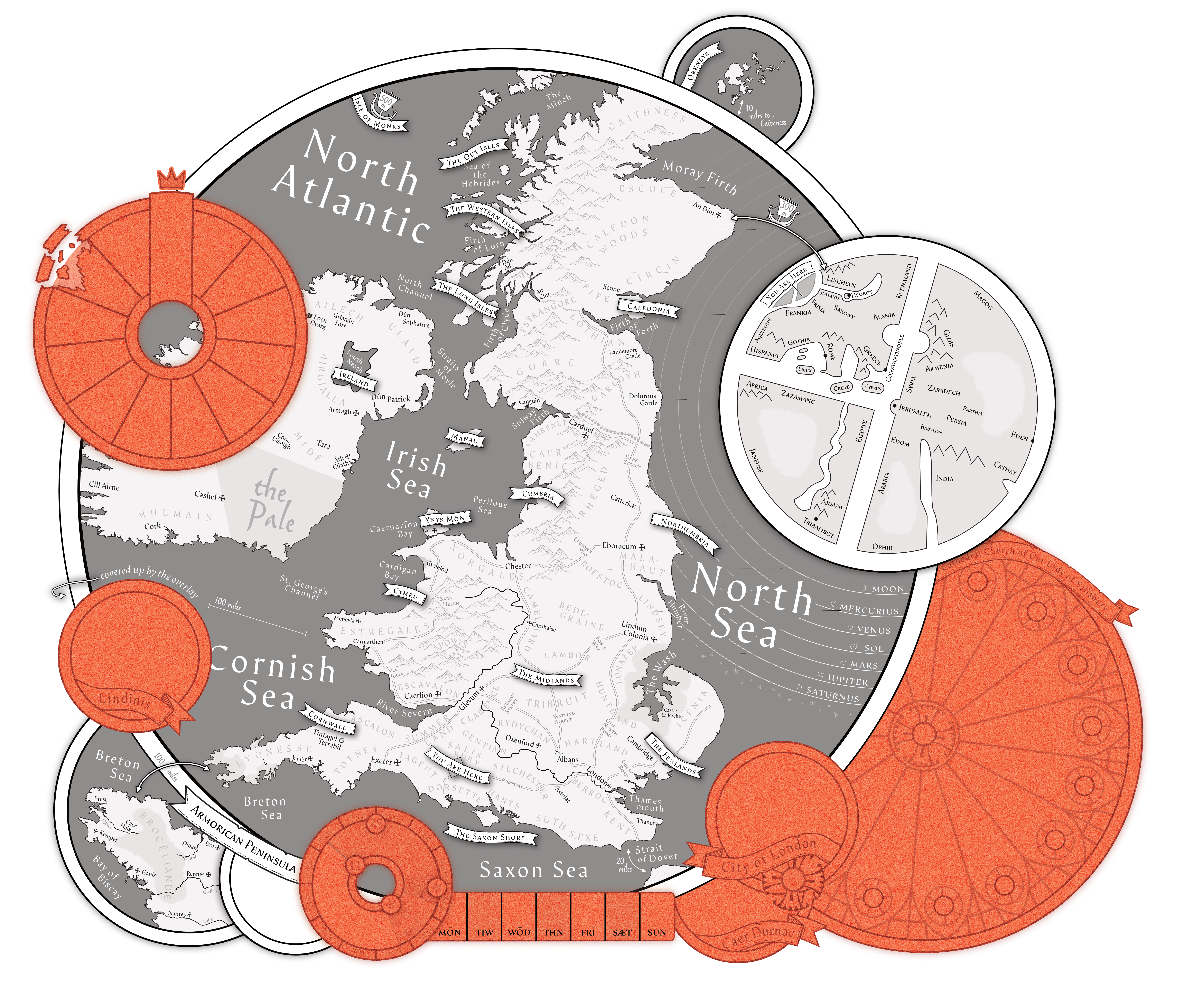
Actually, two broader maps. The first is the core “wider world” of Britain27 where most adventures would take place. I tried to stay fairly timeline-neutral on what was depicted, and provide general regions and major landmarks28. Similar to the local map, I also especially highlight the road network and an obsessive amount of water features. I want players to feel like experts when they describe the ways people might travel from one place to another29.
Two further insets cover Brittany, or Armorica30, slightly moved from its true location to fit it in the map borders, and the Orkney islands in the north3132.
And on an even larger scale, the wider world as a T and O map33, and, for further obscure use, the celestial spheres34.
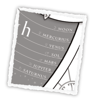
Will characters go to space? I presume not, it’s more of a fun reference.
But I do expect the T and O map to have some use. There’s a few adventures onto the Continent at least, and it’s good for a general geographical grounding as characters, goods, ideas, and political concerns come from distant lands.
It is intentional obscure—not just for stylistic reasons, but to let the ground between the more fantastical elements you’d see on a medieval map and the real ones blur a bit more. You know your local area well, your broader political context pretty solidly, but the distant world only in generalities.
Not the Scope of the Map
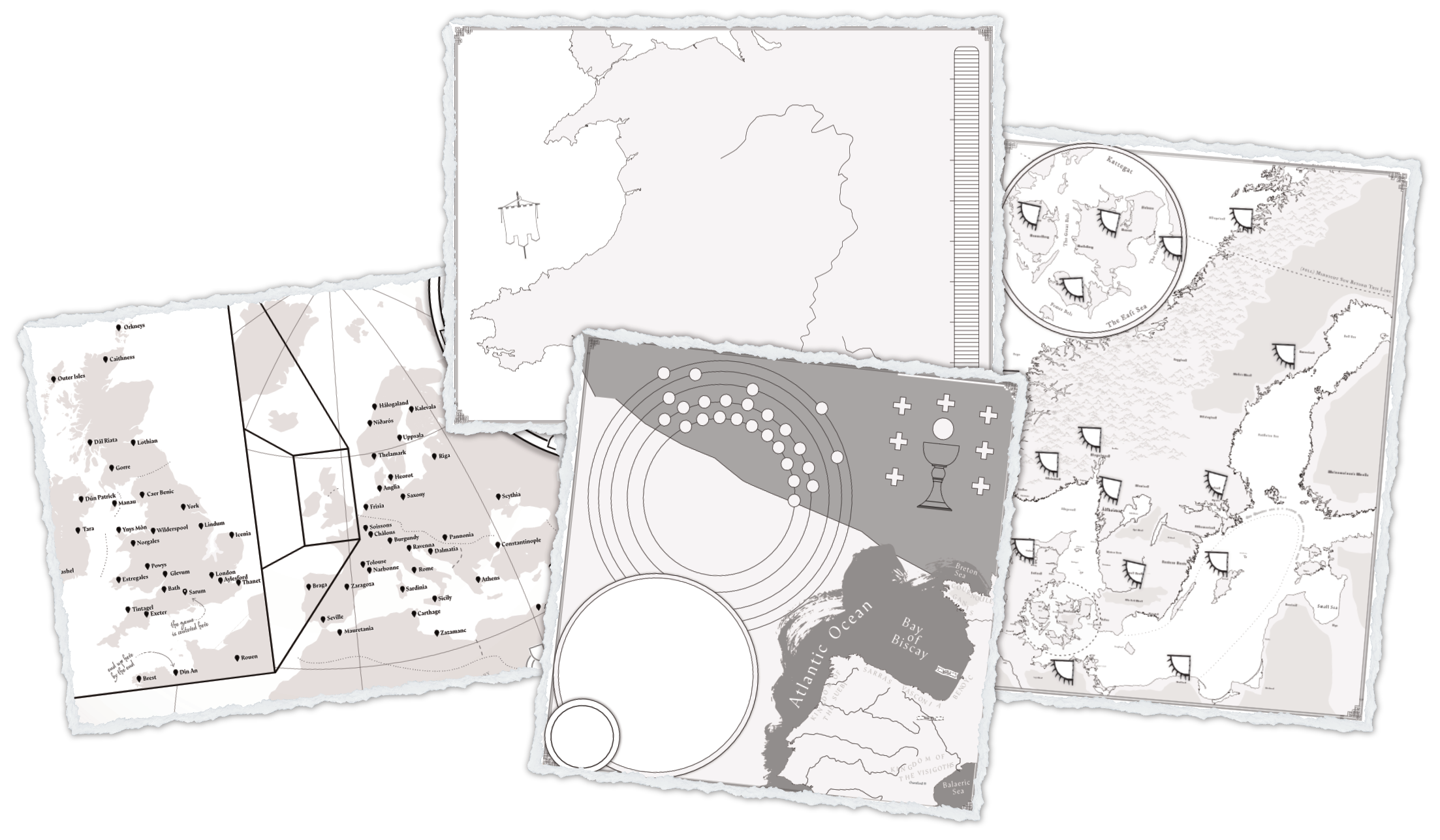
The insets replaced my earlier plans to have many region specific maps. Partially… good maps are a lot of work, and I’d rather have one good one than a couple hastily made and unwitted ones. Partly it’s just a loss of focus on the part of the game I think matters; everything out there happens, but everything in here is where as a character I really put my mark on the map.
That said, I do still have a few other maps as potential supplements. I think any such map would need a few criteria:
- The players can’t get a clear enough idea from existing maps of where things are relative to each other.
- There’s some other gimmick or mechanic that the map helps visualize.
- Players have a reason to need to revisit and make independent plans around it.
- They’re smaller sub-maps. Maybe just 2 by 3 or 2 by 1 foot.
The most obvious place for a map, I think is Family History. It’s less trying to be a diegetic impression of the character’s knowledge, and more to ground the players themselves.
I considered close up maps for some of the major battles (Badon Hill, Camlann, etc.) but I think that’s mostly just a wisp of an idea. I can’t think of any way they’d inform player decisions in a fun way beyond what “theater of the mind” play would.
There are some prolonged expeditions to Wales35, Ireland, the Continent, Scandinavia and the Grail Quest36. Scandinavia is probably the longest (7 years) and has a lot of detailed locations, with maybe a gameplay element of steering different regions into alliance one way or another37, while Wales has perhaps an important element of mountain passes38. The Grail Quest might have some interesting metaphysical elements to map as well.
The only shared element of all of these potential extra maps39 is that they’re not the main map. They’re a side set of rules, separate from how players interact with their main map.
Which is through a lot of little dots…
Putting Your Mark on the Map
The stickers in A Wind Age, A Wolf Age proved very effective40, so I immediately thought to use that but smaller (they look nice, but take up a lot of space).
I initially tried plain uncut sticker paper41 with a hole punch42. Using uncut sticker paper would allow for a lot of variation printed into the dots, even at a small scale43 and maybe even allow for other shapes to represent different details.
This… doesn’t work very well44. But there are a lot of quarter-inch colored dot stickers out there—enough for reasonable variation.
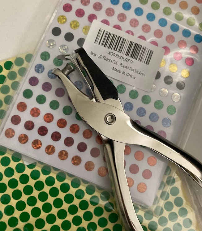
Some are even sparkly45.
Confidence and Supply
The general idea is that as each family extends their estates, picking up property and minor titles, they can put these dots on the board to represent where they have Presence, giving them a sort of “voting power” in the area—whether that’s a large marked area (like the Briar’s Wood), a specific hundred political boundary (like Birdsmarsh Hundred), or a general area (like near Chippenham or among those close enough to patrol the Rannsdyke)
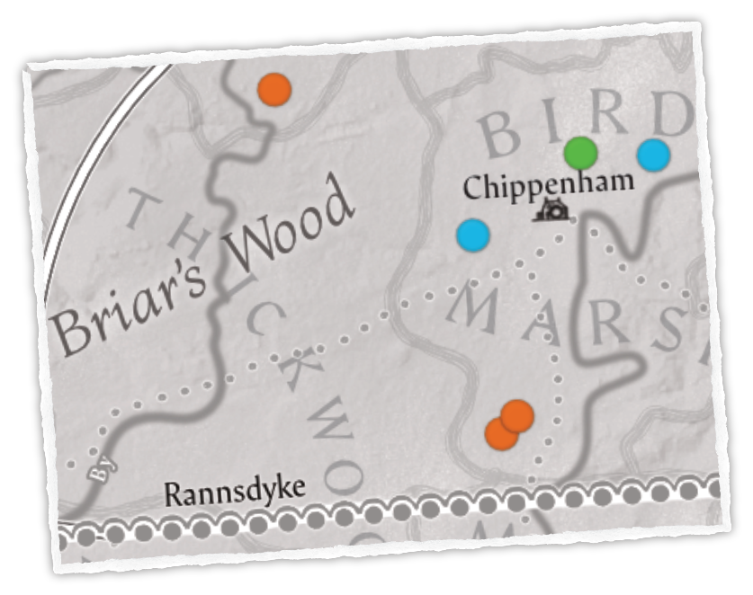
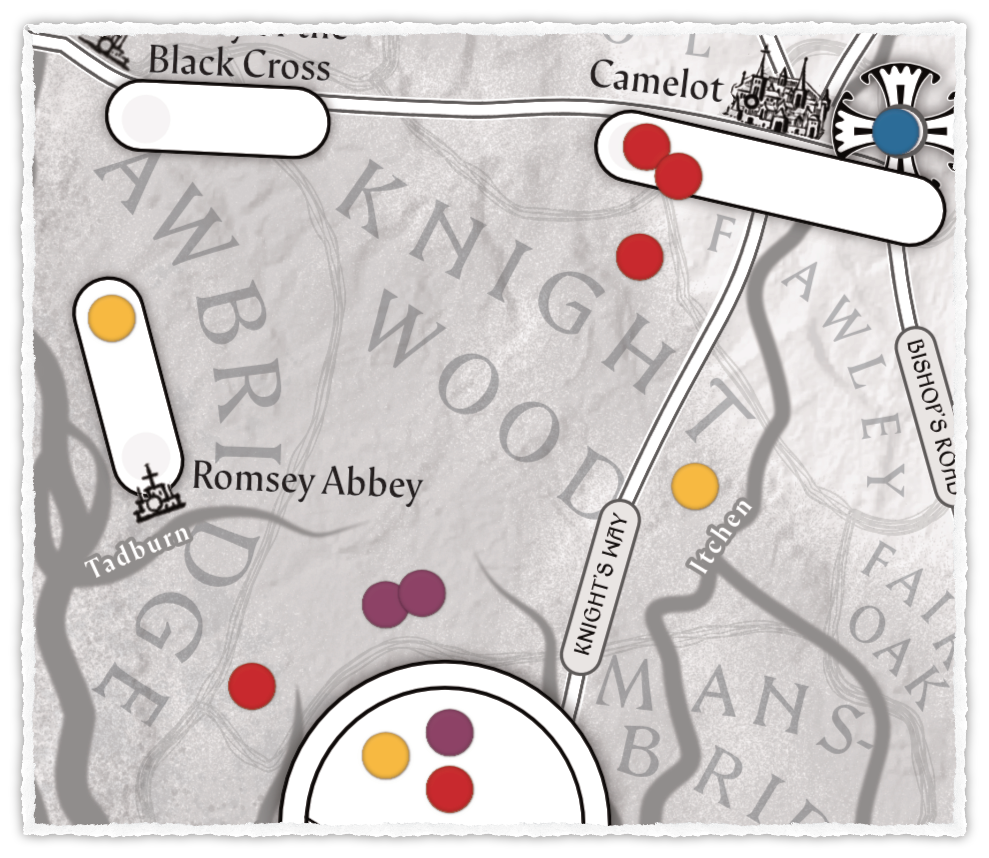
Areas that would have a lot of influenced piled up in one place, like a major town, have a special place to mark down Presence.
For example, take the below setup where gold has some influence in the internal politics of Romsey Abbey, red has a presence inside the city or castle of Camelot itself, blue has sway over the Bishop of Camelot46, and multiple parties have further estates down towards the southern coastal towns47.
Like with A Wind Age, A Wolf Age, I want this to give players a sense of strategy and a hunger for power. But I also want this to encourage cooperation with each other and NPCs; to have a single family’s power structure rarely be enough on its own.
I want48 the feeling of coalition politics in multi-party democracies; where majority control is often a negotiation, with shaky confidence-and-supply agreements, realignments and pivots that can make strange bedfellows49, whips and backroom deals.
For this we have to get to “actually, I do have another big map - it’s just not a map map”.50
It’s a relationship map.
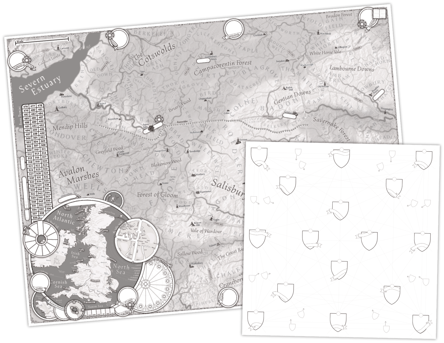
With room for 16 families with lines51 connecting each one, this is meant as a way to chart out major relationships with the other houses of the area, with the family coat of arms, Presence dot color, and name on each shield, and then lines drawn and labeled between them for each feud or friendship.
I’d additionally like to have the main “decision points” of a family be its Presence, some degree of Accord or cohesion, and these alliances and feuds. Maybe you have a family with their fingers in every proverbial pie, but you can’t whip them to sacrifice for the shared ideal as easily as a smaller house52. Maybe you have a lot of enemies but they’ve shored up your house unity, or a lot of friends but they keep asking for you to not support your own interests over their own ones.
How I plan to do that is a topic for another article… once I figure out what it actually would look like53.
Other Silly Things
There’s a few non-map references put on the map, partially for the maximalist style, partially because I just kept putting things in when I had space, and partially because I think they’d actually be useful.
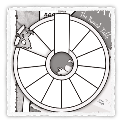
The Round Table is a place to mark the current knights sitting the Round Table. Even if these knights are not major players in other ways54 they’re relevant celebrities the characters probably know and may look up to.
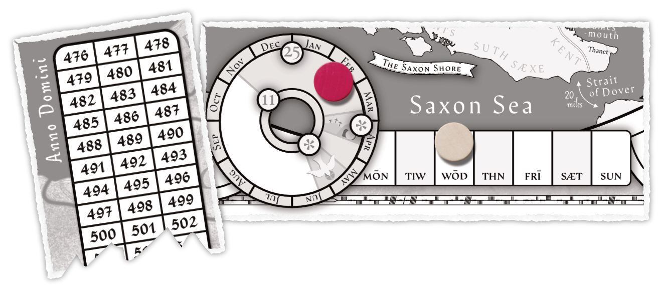
Not content with just tracking space, I also have a few points to track time; after all This is a Game About Time, though I don’t intend it to be an always essential clock in the way some rpgs track it.
The long row of years is meant to help visualize how far through the campaign you’ve come, slowly burning out like a candle.
The circle of months and row of week days (in the English style) are meant to help players mark out dates when it matters for travel or meetings or so on. The months also separate out the Winter and Campaign seasons and the major feasts that differentiate them (Martinmas, Christmas, Easter and Pentecost55). I made little illustrations for them, which I’d like to extend to the other time periods, but actual art is hard56.
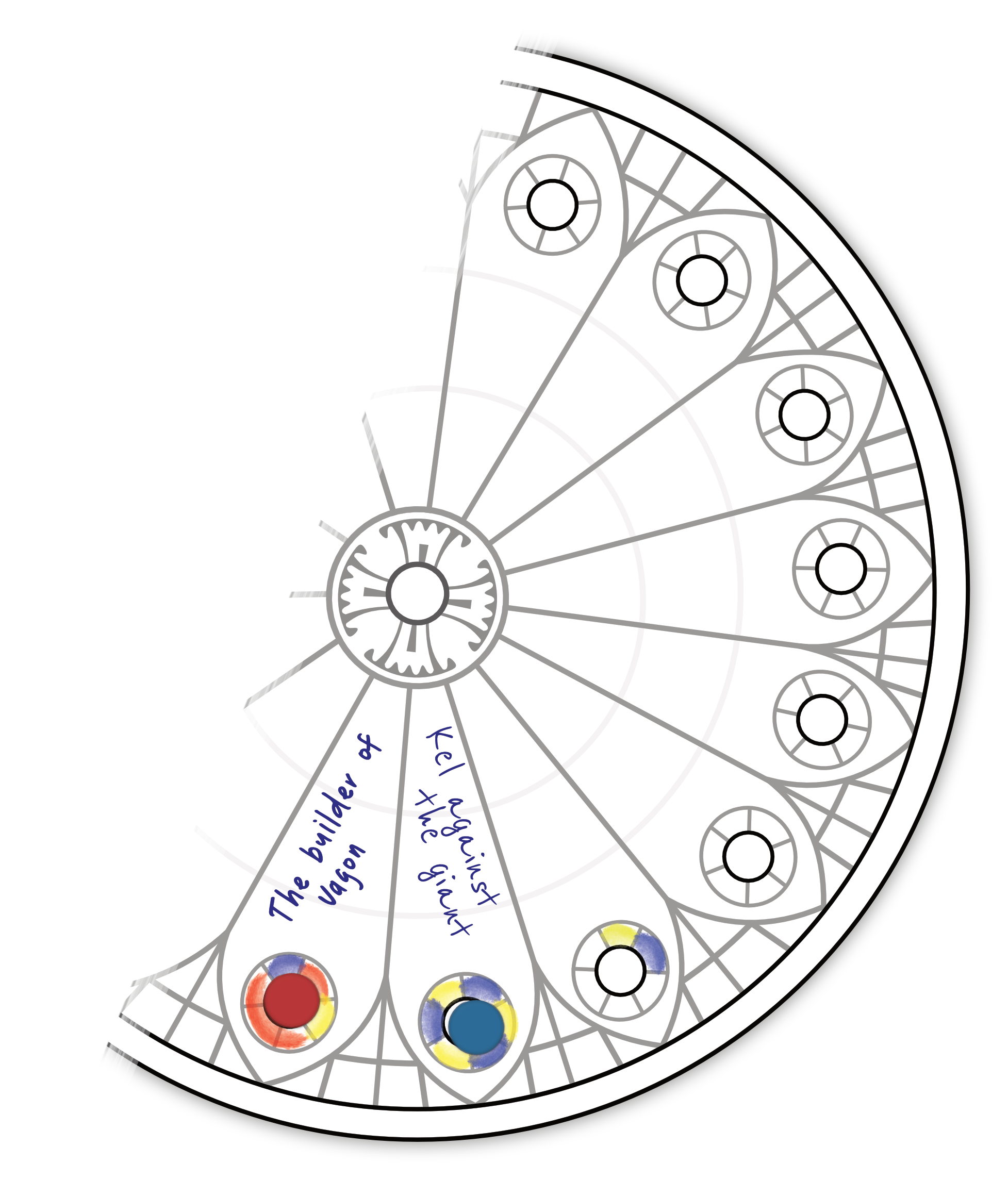
The Cathedral Church of Our Lady of Salisbury represents a way to gain acclaim and influence in the region as a great Cathedral project is built through the period, as well as hiding the marker for control of the Bishop of Salisbury.
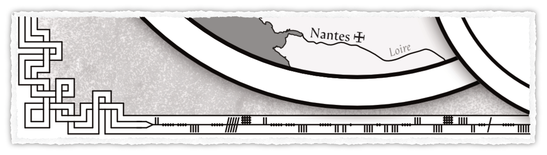
Finally, the border of the map is written in ogham. I’ll leave it as an exercise to the reader what this says.
Footnotes
-
There are also some minor points that could be enhanced, text rearranged a bit, etc. - but this is the first time there hasn’t been a big empty spot staring back at me. ↩
-
Which, to be fair, is partly illuminating about how long I procrastinate on writing. ↩
-
It’s colorful in the pdfs/books, but of course we had a black and white printout, and I remember the gradient and background turning out unhelpfully dark on it - so I’ve tried to photoedit this screenshot to be as authentic as I can. ↩
-
The small, mostly word-filled hexes, differentiated by random encounters and a couple minor kingdom bonuses for conquest, didn’t make the sense of space particularly relevant for deciding where to travel or understanding local politics. But on the other hand, in not wanting to restrict the world of the map by making geography important to the gameplay, the mechanical difference of available tiles wasn’t ever much of a focus either. The realm just grew at a pace of X tiles every few sessions, along paths of no resistance, and internal politics of the realm followed characters much more than any regional strategy. ↩
-
And fantasy literature as a whole, post-Middle-Earth. ↩
-
I wanted at least seven. After running with two in A Wind Age, A Wolf Age and considering more about the place of knights in the world, I don’t think this was the right idea. ↩
-
Without needing to pass the reference sheet between players as each one checks it individually, which has to happen with small maps (or everyone feels a little uncomfortable huddling in and craning over the thing). Having a map that’s large enough for everyone to point as they’re talking to each other is a meaningful distinction. ↩
-
Thanks to living near a print shop, 3 ft by 4 ft. Table size, etc. matter but I’ve found this to be a really great map size. ↩
-
It was only so large because I thought it might end up efficient to double-sided print it on one side and the world map, which I had actually planned out, on the other (it wasn’t - but there was still a small discount for printing two things instead of just one at the print shop). ↩
-
Perhaps more generally a fantasy of competency, if I’d theorize. The person staring at the map can see everything from an elevated view and casually wave their hand over big actions, but they’re important decisions too. ↩
-
Quartered 1-inch circular stickers styled as raven banners carrying family colors; because just writing down who was where was incomprehensible at a distance. ↩
-
Also that could expand as the players grew. The island proved very tight (I also set the players up with a lot of control early on) and even when larger scope threats came into play, there was no way to think about both them and the island at the same time. ↩
-
This also means a more focused story. Not that characters won’t go on adventures in the rest of the world, but that more things would tie back to the one local area, with an expectation that grants of land outside of that would be less relevant. ↩
-
Which also means a less evolving map. Instead of trying to map every border and every border change, requiring the map to be swapped out each time, I aimed to have a map where the underlying details would all stay the same throughout the campaign. ↩
-
Turns out locations that are visited once can easily be described once in relative location terms, and players will just accept it. ↩
-
Especially the narrow neck of the island. ↩
-
Which can end up preserved or overharvested, handled lawfully or criminally, a place for good or bad neighbors to shine. ↩
-
As both may be threats to the other. ↩
-
The idea is partly to give players a modern interface they understand (the kind of “clouds showing up on the weather station map”) but can also put viscerally to the smell and feel everyone knows of being in an open area where you know a storm is rolling in. Both in reminding knights that they are small and reminding players that they are not in the modern world with its conquests of nature, I want storms to be something that feels meaningful and vast; a looming threat on the horizon that you can plan around but rarely plan through. ↩
-
Also more densely populated, so even for the same area there’s more closely bundled areas. ↩
-
It’s a tiny bit more zoomed in and a slightly shifted area in focus, but it’s clearly the same basic idea. ↩
-
My earlier plans were for the long edge to be north-south for a more vertical map. ↩
-
Which either limits what the players can do or means you have to redraw the map multiple times during the campaign. ↩
-
Partway through A Wind Age, A Wolf Age, for instance, an external faction was married into, but there was no easy way to represent where there influence was or how much it was on the map, since the island was already known. ↩
-
I’d intend for these further regions of the map to remain under the “fog of war” a bit more until interacted with (otherwise it’s just a bigger problem of pre-planning and pre-running all these faction dynamics). You don’t need to track every family and all their presences everywhere - just whenever a new area becomes important to the players, we can reveal a little more about what else is important there. ↩
-
And the closer parts of Ireland. ↩
-
It’s not all of the places you’d go or even reference often, but I wanted a reasonable spread so any specific location could easily be described as “near _” with something close enough. ↩
-
And I found all the water names fun. ↩
-
Part of the continent but closely tied to the island (I’d also keep Britonia in there if I could fit it; there are interesting points there, I think), so it’s useful to have a little more detail. Also a good place to start players in. ↩
-
Which aren’t actually scaled or moved; that’s where they’d be if the map extended. Scotland really just cuts off right where the border of the main circle lies, and the Orkneys are right off of it. ↩
-
The Shetlands aren’t that much further, but less of a major point to reference. ↩
-
Rotated from the traditional East-is-up orientation; the three scales are oriented the same way, so this can act like a compass rose for this too. ↩
-
The Cambrian War scenario from Savage Mountains ↩
-
A more broad-brush influence game than local Presence dots, which would be less useful this late. ↩
-
The Cambrian War is presented as a counter-insurgency war, where strategic decisions about your lines of supply and what alliances, bribes, and hard-power plays matter. If done well, I think that could merit an interesting side-map. ↩
-
Beyond being wildly incomplete. ↩
-
I guess legacy board games know what they’re doing. ↩
-
Which… I just had around. ↩
-
Which I didn’t have around. I did have to buy one for this experiment. ↩
-
And even with my somewhat off-kilter printer - because you can choose where you make the cut after the print happens. ↩
-
It’s maybe feasible. It’s just really hard to separate the very tiny sticker from its very tiny hole-punched backing. You’d spend too much time in session just picking at it. ↩
-
Probably the ones to have the players pick, so there’s a little bit of an immediate distinction between player and NPC households. ↩
-
Maybe specifically a family member sitting in the bishop’s seat, or just one indebted to them. ↩
-
The bigger circles like this one are a way to “extend the map” for family’s whose influence isn’t quite on the board, but still is important to major players in the area. ↩
-
Though I’ll be pretty vague at this point as to how I hope to get to this state. ↩
-
Which, as a dynastic game, might be more literal than in (most) multi-party democracies. ↩
-
I have also considered a map for Scandinavia (due to a potential prolonged adventure there; not using Presence but a larger granularity minigame), Wales (for the Cambrian War scenario - another one that could have a very visible minigame-on-the-board tracking things), and a few other special cases. Like the connections map, though, these would all be smaller than the main map, so they’re meant more like an overlay. ↩
-
Some… a little more irregular than others. ↩
-
As a differentiating factor more than a limiting factor. Quantity has a quality all of its own, as they say, and a wide but non-cohesive family presence can still make someone very flexible in what they can do. ↩
-
Or even figure out more of what I want out of it, like Downtime Abbey did for downtime. ↩
-
i.e. kings and nobles, or people with a lot of ties to the lands the players care about ↩
-
The latter two don’t have exact dates but a range of dates as it changes each year and between traditions (that are in contest in Britain at this time). ↩
-
I had text for Winter vs. Campaign before, but it’s also not been super satisfying. The plain shading works but this is a point I’d like to figure out a better solution for at some point. ↩
